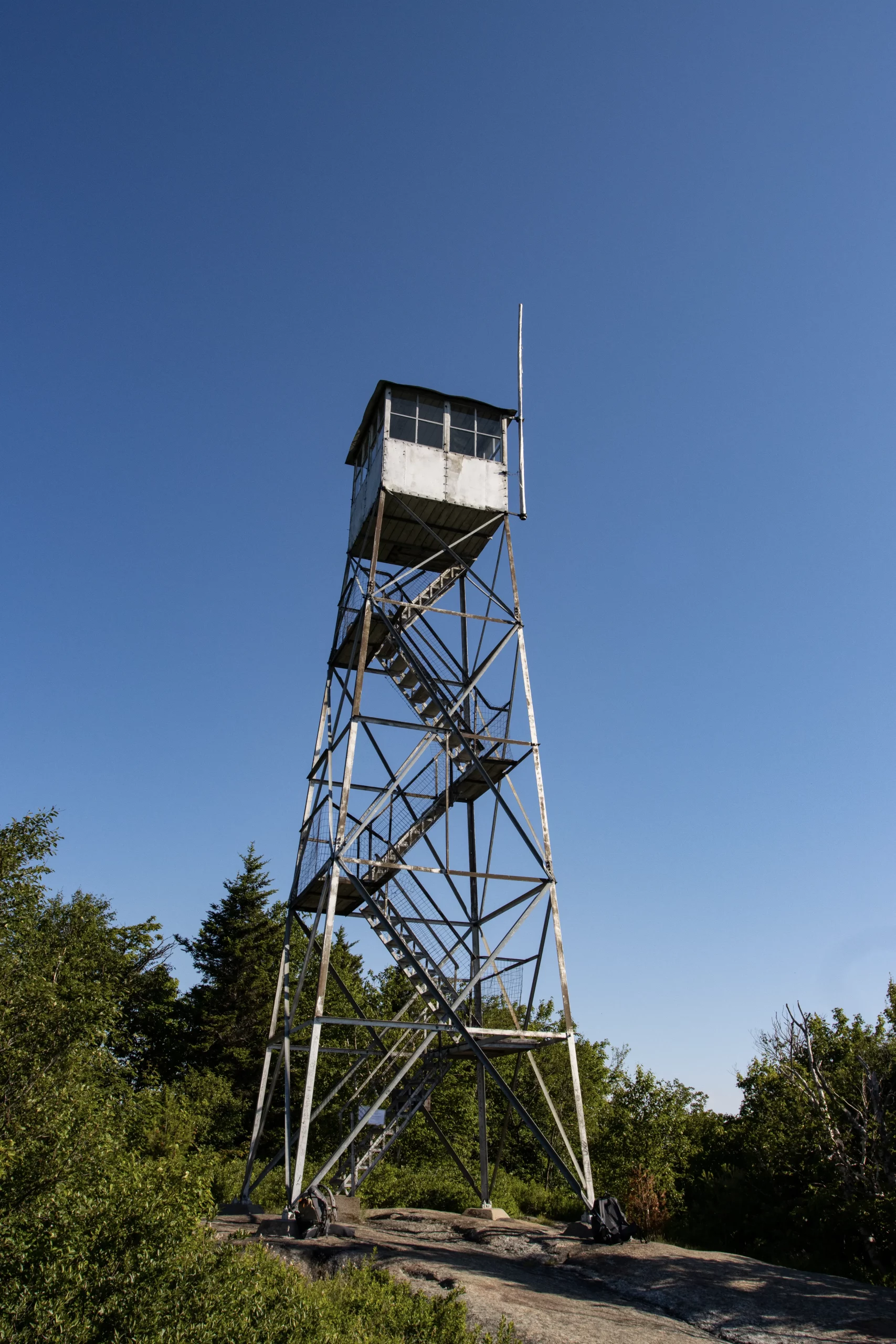
Poke-O-Moonshine Mountain - 2,748'
Poke-O-Moonshine is another sweet one, a great open peak with a solid tower and a light and easy trail. This one is incredibly mild and goes pretty quick, about 4.5 miles. The views here are spectacular and the traversable area on the peak winds around the edges for more views and interesting things to see. I would easily classify this Fire Tower as one of the best, alongside Hurricane and handful of others.
The trail up to the tower goes out and takes a deep right hook, which means your views are pointing towards the roads you came in on and the lake you drove by (very cool to see sometimes.) On the right side of the peak there was a sharp cliff were hooks and set loops for what appears to be mountain climbing, which was very cool to see, and not as common as you might think.
This trail is also one of those ones that has some odd old relics scattered around from the good old days, including a decrepit lean-to and the remains of some foundation and chimney bricks. There is a lot going on here and this climb is one that warrants repeat visits.
- We only ran into 1 other person on this climb, the lot was completely empty.
- The trail was pretty solid over all and in surprisingly good shape.
*this excerpt was salvaged from the now defunct www.nysforestrangers.com, thanks to the Way Back Machine, written by Captain Paul T Hartmann (ret.)*
LOCATION: 7 miles south of Keeseville and west of I-87.
STATUS: Restored and open to the public.
The first structure on Poke-O-Moonshine was a wooden tower erected by the Conservation Commission in 1912. In 1917 the wood tower replaced with a 35′ Aermotor tower.
In 1919, the third generation of a device known as the Osborne Fire Finder had been developed by the US Forest Service. By means of this instrument, a panoramic map of the territory visible from a mountain station could be prepared.
This made it possible for an inexperienced observer to locate fires more accurately than by using ordinary topographic maps. The Osborne was first tried out at Poke-O-Moonshine Mt. during that same year and a map was made. It was considered so successful that in the years to follow the Osborne was carried up to each mountain station and a map made. This project took several years to complete.
Panoramic maps were ultimately provided to all towers to aid the observer in locating fires. This was a circular map with a panoramic sketch of the surrounding vista around the outside edge as can be seen in the photo below.
The inner portion was a topographic map with the tower location in the center. A sighting device called an “alidade” pivoted on a pin in the center of the map. Along the outer edge of the topographic map portion are azimuths that could be easily read by the observer once the alidade was sited on a possible fire.
The outermost edge of the map is the panorama or a sketch of what the observer could actually see from the mountain station. While these were very helpful to the observer in locating a possible fire, there was a downside to the concept.
The diameter of the circular map was only 12 inches. This allowed the observer to do a reasonably good job of locating a fire within six miles of the station, but locating fires further distant was still difficult.
Vast areas of the Adirondacks and Catskills didn’t appear on any stations maps requiring they use the previous methods of location. Triangulation, as a method of locating fires, didn’t come in to its own until the 1940’s.
Years later, use of a 30 inch diameter map was instituted that effectively did away with this problem but created another. The panoramic sketches that were so helpful to the new observer had to go.
This tower ceased operation at the end of the 1988 season. The tower was officially closed in early 1989 when the Department of Environmental Conservation determined that towers were no longer effective and decided to phase them out of service.
In 1994, a group known as the Friends of Poke-O-Moonshine was formed to save and restore the tower.
Poke-O-Moonshine appears on both the National Historic Lookout Register and the National Register of Historic Places, being placed on the latter on Sept 28, 2001.
Poke-O-Moonshine is one of the mountains included in the Fire Tower Challenge sponsored by the Glens Falls-Saratoga Chapter of the Adirondack Mountain Club (ADK). “To complete the Challenge and receive the official full-color patch, hikers must climb and document, by date, ascents of at least 23 fire tower summits: 18 of 23 Adirondack Park summits and all 5 Catskill Park summits.”
We Give This Trail: 8/10
Rating considers trail conditions, difficulty, views and other notable characteristics


